The world of digital maps is slowing becoming clear to the team, thanks to the patient explanations by Marcus Simmons. We now know that we have to have a base layer - a digital map which has some basic map information on it. To that map we can add different layers. For example we could add a tree layer which showed where all the trees in the city are. You can view the layer on top of the base layer and see where the trees are. Then you can add other layers. We now need to decide what other layers we need. If you have any insights and want to get involved, please get in touch.
Mapping without computers
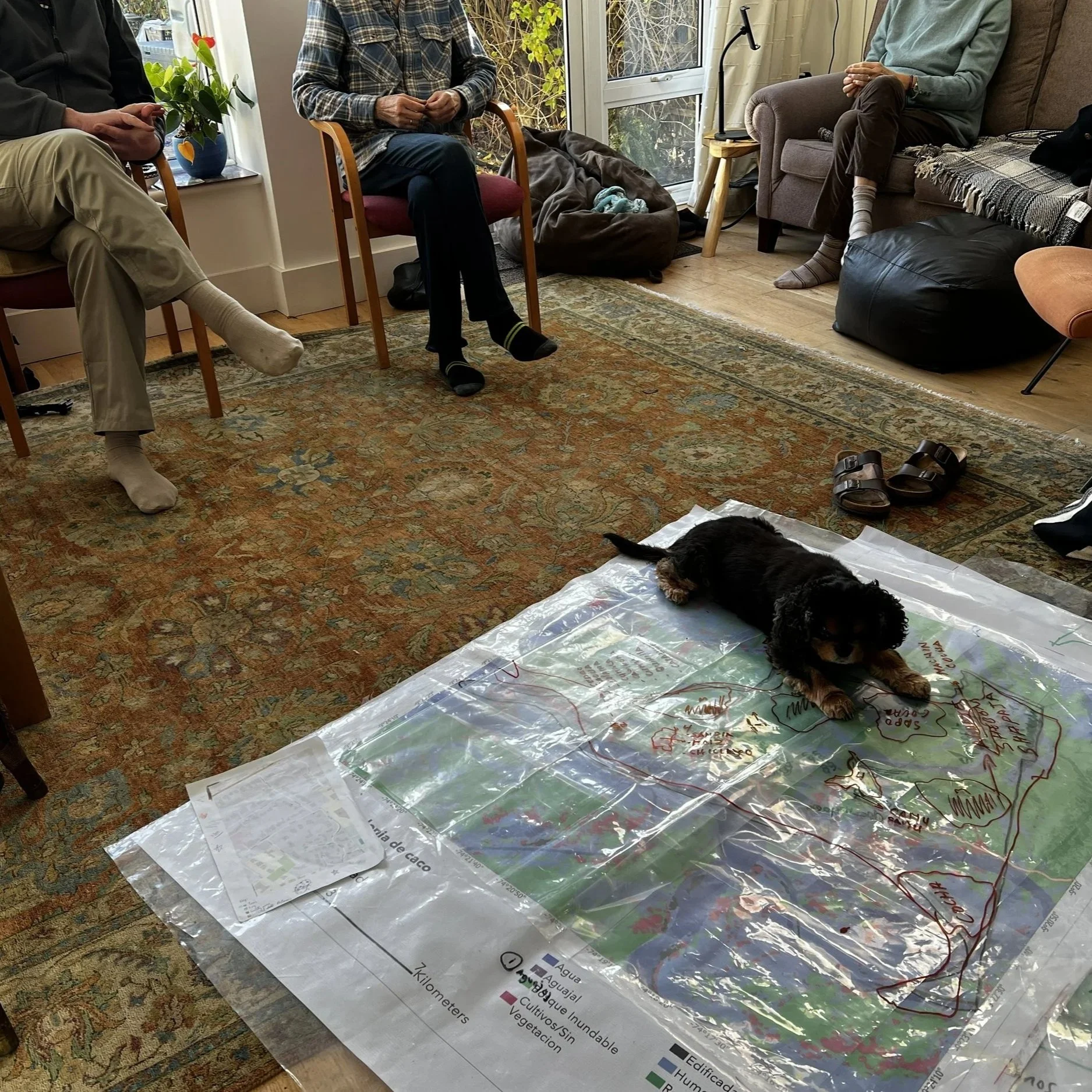
The ONP team were really grateful to Dr Aoife Bennett who gave up hours of her time to come and share her expertise in mapping with groups of people, without going direct to computer. Her work in Peru has involved mapping with indigenous communities and she has developed a method of creating base maps digitally, printing them on robust plastic, and overlaying transparent plastic sheets on them that people can then draw on to add their knowledge and their ideas. These transparencies will then be digitised back in Oxford.
It was fascinating seeing and handling the marked up transparent sheets that people so far away had created. We were really inspired and are adding it to the mix of options for working with local people in Oxford.